


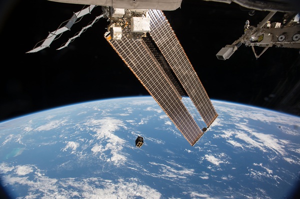
On April 27, 2016, Diwata-1 became the first Filipino-built satellite in orbit, deployed from the JEM Small Satellite Orbital Deployer aboard the International Space Station. (Photo credit: Japan Aerospace Exploration Agency/NASA)
Philippine Space Agency marks a decade since the launch of Diwata-1, a milestone that transformed the country’s approach to disaster management and space technology development.
The initiative traces back to the aftermath of Typhoon Yolanda, when limited access to satellite imagery exposed critical gaps in disaster response capabilities. This prompted the Philippines to invest in building its own satellite systems to ensure direct access to real-time Earth observation data.
Launched on April 27, 2016, from the International Space Station, Diwata-1 became the first Filipino-built satellite deployed into orbit. Beyond its symbolic significance, the microsatellite enabled local engineers to develop end-to-end capabilities—from satellite design and operations to data processing and mapping.
The program laid the groundwork for more advanced platforms such as Diwata-2 and the Maya CubeSats, expanding the country’s expertise in small satellite technologies. These efforts were institutionalized with the creation of PhilSA in 2019, which now leads national initiatives in space science, technology, and applications.
Today, satellite data plays a critical role in disaster risk reduction and environmental monitoring. PhilSA regularly provides geospatial intelligence to government agencies, including mapping fire impacts, earthquake damage, oil spills, and flood extents—enhancing response speed and decision-making for local government units and the National Disaster Risk Reduction and Management Council.
Looking ahead, the Philippines is preparing for the launch of the Multispectral Unit for Land Assessment by early 2027. Designed as a high-capability Earth observation satellite, MULA is expected to deliver more precise and frequent data for land use monitoring, environmental protection, and national planning.
The evolution from Diwata-1 to MULA highlights a broader shift toward technological self-reliance, where local satellite production and data processing capabilities reduce dependence on foreign sources. It also underscores the growing role of space technology in addressing real-world challenges—from disaster resilience to sustainable development.
A decade after Diwata-1’s launch, the Philippines continues to strengthen its position in the global space ecosystem, leveraging innovation and local expertise to turn space-based data into actionable insights for national progress.