






AI
PhilSA uses AI and satellite data to map flooding in Northern Luzon
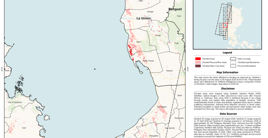
Sample flood extent map (one of 25 maps generated from available satellite data) showing flood-affected areas across Regions 1 and 2 following heavy rains brought by Tropical Storm Maymay and the enhanced Southwest Monsoon (Habagat). The map was produced by the Philippine Space Agency (PhilSA) using Sentinel-1 Synthetic Aperture Radar (SAR) imagery and AI-assisted flood […]
info-aitimes-phgmail-com
- August 12, 2026
- 0 Comments
- 95 Views
-