







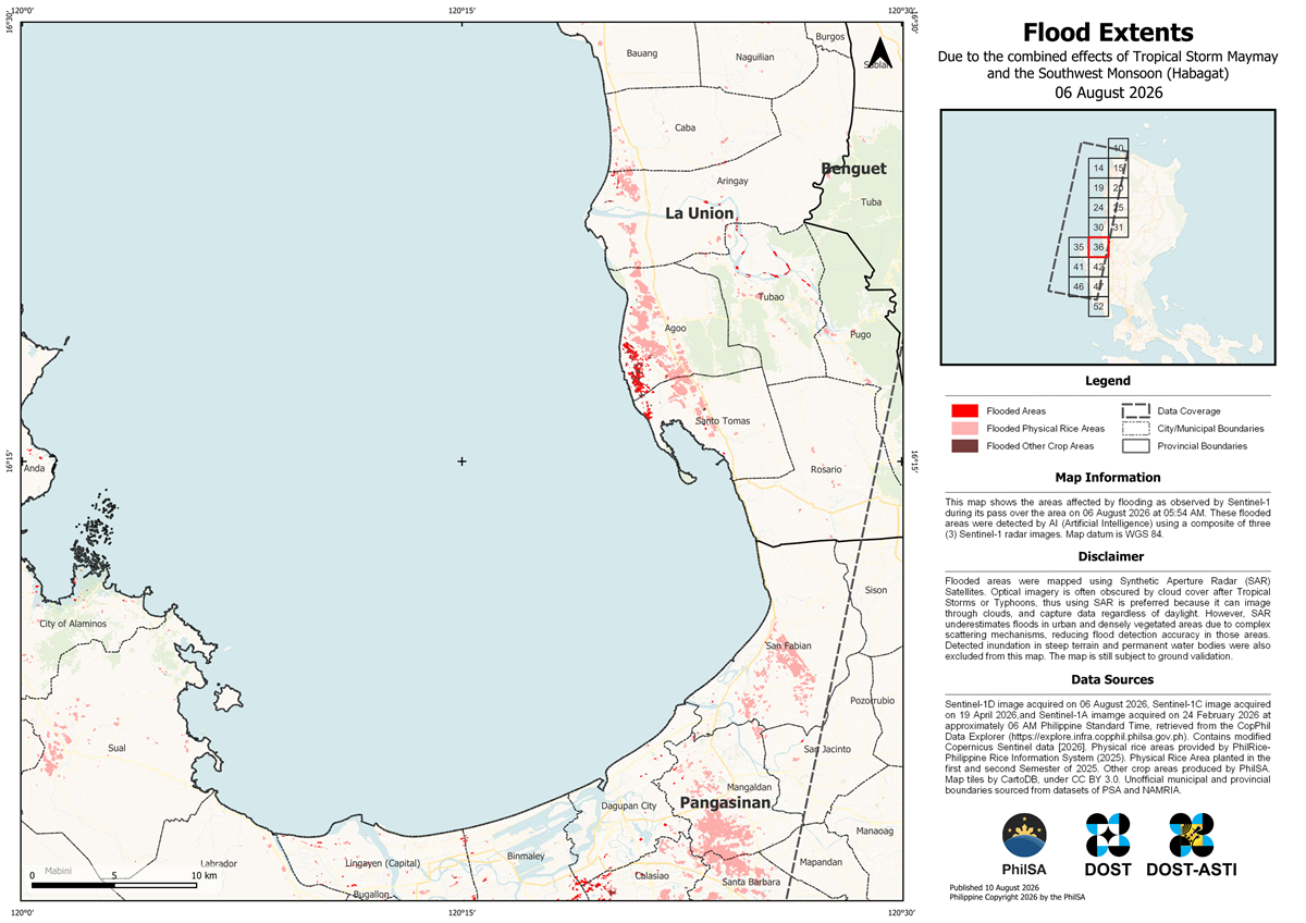
Sample flood extent map (one of 25 maps generated from available satellite data) showing flood-affected areas across Regions 1 and 2 following heavy rains brought by Tropical Storm Maymay and the enhanced Southwest Monsoon (Habagat). The map was produced by the Philippine Space Agency (PhilSA) using Sentinel-1 Synthetic Aperture Radar (SAR) imagery and AI-assisted flood analysis to support disaster monitoring and response efforts.
The Philippine Space Agency (PhilSA) has released flood extent maps identifying inundated areas across Region 1, Region 2, and parts of Abra and Zambales following heavy rains caused by Tropical Storm Maymay and the enhanced Southwest Monsoon (Habagat).
The maps were generated using Sentinel-1 Synthetic Aperture Radar (SAR) satellite imagery combined with Artificial Intelligence (AI)-assisted analysis. PhilSA used SAR images captured on August 6, 2026, for Region 1 and on August 9, 2026, for Region 2 to detect and assess flood-affected areas.
According to PhilSA, AI was used to analyze a composite of three Sentinel-1 SAR images, enabling faster identification of flooded zones across large geographic areas. The use of AI and satellite-based Earth observation technologies allows authorities to obtain near-real-time information that can support disaster response and recovery efforts.
Unlike optical satellites, SAR technology can capture images through cloud cover and during both day and night conditions, making it particularly valuable during severe weather events when visibility is limited. However, PhilSA noted that SAR imagery may underestimate flooding in densely built urban environments and heavily vegetated areas due to signal interference and backscatter limitations.
The agency emphasized that the flood maps remain subject to ground validation to confirm the extent and accuracy of detected flooding.
PhilSA is supporting the National Disaster Risk Reduction and Management Council (NDRRMC) by providing satellite-based assessments that help authorities monitor conditions, prioritize affected areas, and improve response planning. The initiative highlights the growing role of AI, geospatial analytics, and space technology in disaster risk management and emergency response in the Philippines.
The agency said it will continue monitoring satellite data as weather conditions evolve and urged the public to follow official advisories from local and national government agencies.