



Tag: Synthetic Aperture Radar

News

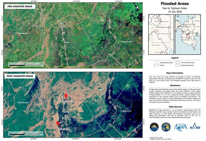
PhilSA uses satellite technology to map floods and landslides after Typhoon Inday

Sample flooded area map (one of six) generated by the Philippine Space Agency (PhilSA) using very high-resolution KOMPSAT-3 satellite imagery captured on July 14, 2026. The map highlights flooded areas in parts of Cotabato and Maguindanao del Sur following the enhanced Southwest Monsoon (Habagat) due to Typhoon Inday. Additional very high-resolution flood maps are available […]

News

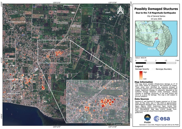
PhilSA Uses Satellite Technology to Map Earthquake Damage and Coastal Changes in Mindanao

The Philippine Space Agency (PhilSA) is leveraging advanced satellite technology to assess the impact of the magnitude 7.8 earthquake that struck southern Mindanao on June 8, 2026, providing critical data to support disaster response and recovery efforts. Using Synthetic Aperture Radar (SAR) imagery from the European Space Agency’s Sentinel-1C and Sentinel-1D satellites, PhilSA generated damage […]

Email Us

For inquiries, press releases, and partnership request, get in touch with us at: info.aitimes.ph@gmail.com.

Contact: 0956-344-3286

AI Times  @2026. All Rights Reserved.