





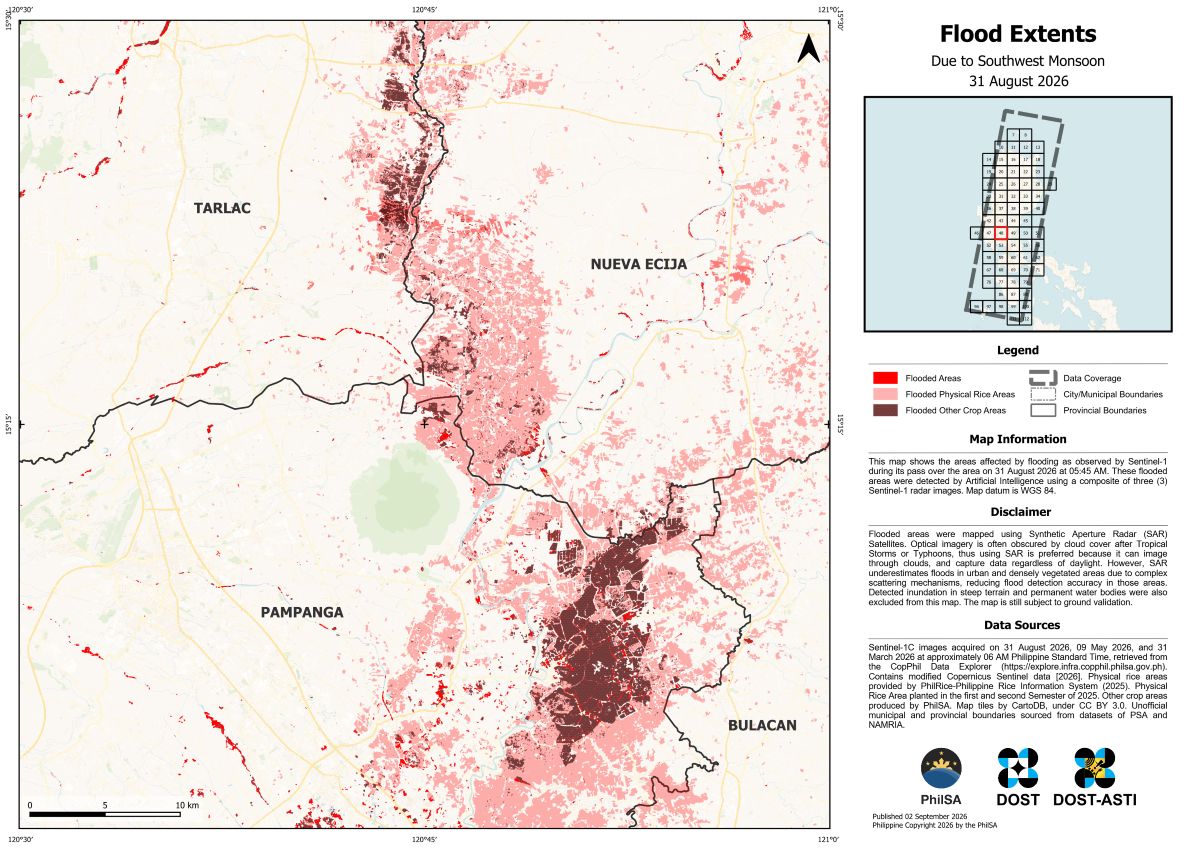
The Philippine Space Agency (PhilSA) has produced flood extent maps covering parts of Regions 1, 2, 3, 4A, 4B, the Cordillera Administrative Region (CAR), and the National Capital Region (NCR), using artificial intelligence (AI) and satellite imagery to support disaster monitoring following heavy rains from the enhanced Southwest Monsoon.
The maps, captured on August 31 at 5:45 a.m. Philippine Standard Time, were generated with the aid of AI using a composite of three Sentinel-1 Synthetic Aperture Radar (SAR) satellite images. The technology enables authorities to identify areas affected by flooding across wide geographic areas.
SAR is particularly useful during severe weather because its signals can penetrate clouds, allowing satellites to capture data even when storm systems obscure the ground. Unlike optical satellite imagery, SAR can also operate regardless of daylight conditions.
However, PhilSA cautioned that SAR-based flood mapping may underestimate flooding in urban and densely vegetated areas, where complex surfaces can affect the satellite signals and reduce detection accuracy. The maps remain subject to ground validation and represent flood conditions only at the specific time the satellite imagery was captured.
PhilSA is providing the satellite-derived data to the National Disaster Risk Reduction and Management Council (NDRRMC) to help monitor affected areas and prioritize response efforts. The agency said making space-based data accessible to stakeholders can support faster, more informed disaster-response decisions.
Flood extent maps and shapefiles for August 26, 30 and 31 are available through PhilSA’s official channels.