


The Philippine Space Agency (PhilSA) is leveraging advanced satellite technology to assess the impact of the magnitude 7.8 earthquake that struck southern Mindanao on June 8, 2026, providing critical data to support disaster response and recovery efforts.
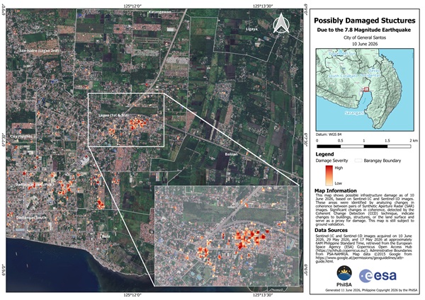
Using Synthetic Aperture Radar (SAR) imagery from the European Space Agency’s Sentinel-1C and Sentinel-1D satellites, PhilSA generated damage assessment maps identifying potentially damaged buildings and structures in General Santos City. Areas highlighted in red indicate significant changes detected between pre- and post-earthquake satellite images.
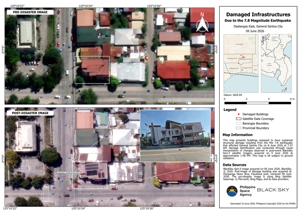
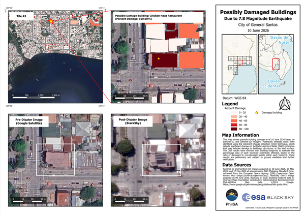
To improve accuracy, PhilSA combined SAR change-detection results with very high-resolution (VHR) satellite imagery, enabling analysts to identify specific structures that may have sustained severe damage. The agency noted that all findings remain subject to on-ground validation.
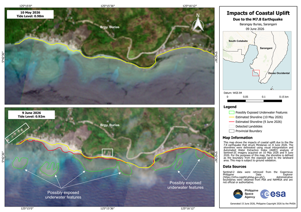
Beyond structural damage, satellite analysis also revealed shoreline shifts in parts of Sarangani Province caused by coastal uplift following the earthquake. Using Sentinel-2C imagery and Automated Water Extraction Index (AWEI) analysis, PhilSA mapped changes in coastal areas, including Barangays Burias and Pangyan, highlighting newly exposed land and possible underwater features.
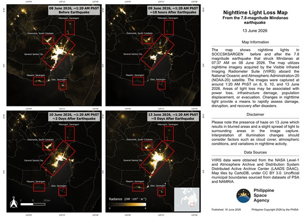
PhilSA is also monitoring nighttime satellite imagery to track recovery efforts. The agency observed the gradual return of nighttime lights in affected areas, an indicator often used to assess the restoration of power, infrastructure, and community activity after major disasters.
The satellite-based assessments provide wide-area coverage that supports the National Disaster Risk Reduction and Management Council (NDRRMC) in prioritizing response operations and recovery planning. PhilSA said it will continue monitoring the affected regions using space-based technologies as conditions evolve.
The initiative demonstrates the growing role of Earth observation satellites, geospatial analytics, and remote sensing technologies in disaster management, enabling faster and more informed decision-making during emergencies.