


News
PhilSA Uses Nighttime Satellite Data to Assess Mindanao Quake Damage
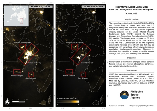
The Philippine Space Agency is leveraging satellite imagery to help assess the impact of the magnitude 7.8 earthquake that struck Mindanao on June 8, using changes in nighttime lights as an early indicator of damage and disruption in affected communities. By comparing satellite images captured before and after the earthquake, PhilSA identified areas showing significant […]
info-aitimes-phgmail-com
- June 11, 2026
- 0 Comments
- 2 Views
-