


News
PhilSA Uses Satellite Technology to Map Earthquake Damage and Coastal Changes in Mindanao
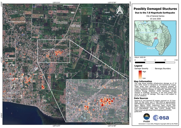
The Philippine Space Agency (PhilSA) is leveraging advanced satellite technology to assess the impact of the magnitude 7.8 earthquake that struck southern Mindanao on June 8, 2026, providing critical data to support disaster response and recovery efforts. Using Synthetic Aperture Radar (SAR) imagery from the European Space Agency’s Sentinel-1C and Sentinel-1D satellites, PhilSA generated damage […]
info-aitimes-phgmail-com
- June 16, 2026
- 0 Comments
- 24 Views
-