






AI
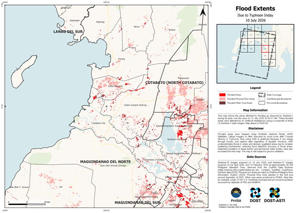
PhilSA uses AI-powered satellite imaging to map floods after Typhoon Inday
The Philippine Space Agency (PhilSA) has released artificial intelligence (AI)-assisted flood extent maps to help government agencies assess flooding caused by the enhanced southwest monsoon triggered by Typhoon Inday. Using Sentinel-1 Synthetic Aperture Radar (SAR) satellite imagery captured on July 10 and 11, 2026, PhilSA identified flooded areas across Regions 9, 10, 11, 12, 13, […]
info-aitimes-phgmail-com
- July 12, 2026
- 0 Comments
- 100 Views
-