


Industry Verticals
News
PhilSA Satellite Mapping Reveals 8,544-Hectare Ashfall Zone from Mayon Volcano Pyroclastic Event
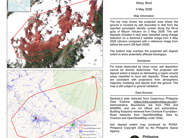
The Philippine Space Agency has released a satellite-based map identifying extensive ash deposits following a pyroclastic density current along the Mi-isi gully of Mayon Volcano on May 2, 2026. Using change detection analysis from European Space Agency’s Sentinel-2 satellite imagery, PhilSA compared data from May 4, 2026 with a reference image taken on April 28, […]
info-aitimes-phgmail-com
- May 5, 2026
- 0 Comments
- 28 Views
-